


 72 / 90

places the primary plant communities along the Rilska Reka river valley are
disturbed by human activity and building constructions.
MATERIALS AND METHODS
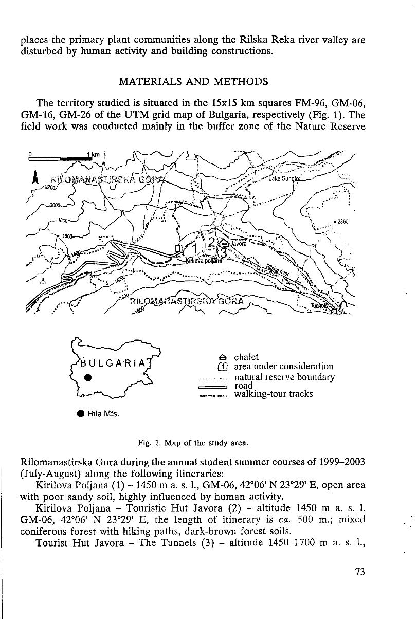
The territory studied is situated in the 15x15 km squares FM-96, GM-06,
GM-16, GM-26 of the UTM grid map of Bulgaria, respectively (Fig. 1). The
field work was conducted mainly in the buffer zone of the Nature Reserve
Fig. 1. Map of the study area.
Rilomanastirska Gora during the annual student summer courses of 1999-2003
(July-August) along the following itineraries:
Kirilova Poljana (1) - 1450 m a. s. 1., GM-06, 42°06' N 23°29' E, open area
with poor sandy soil, highly influenced by human activity.
Kirilova Poljana - Touristic Hut Javora (2) - altitude 1450 m a. s. 1.
GM-06, 42°06' N 23°29' E, the length of itinerary is
ca.
500 m.; mixed
coniferous forest with hiking paths, dark-brown forest soils.
Tourist Hut Javora - The Tunnels (3) - altitude 1450-1700 m a. s. L,
73
Электронная Научная СельскоХозяйственная Библиотека